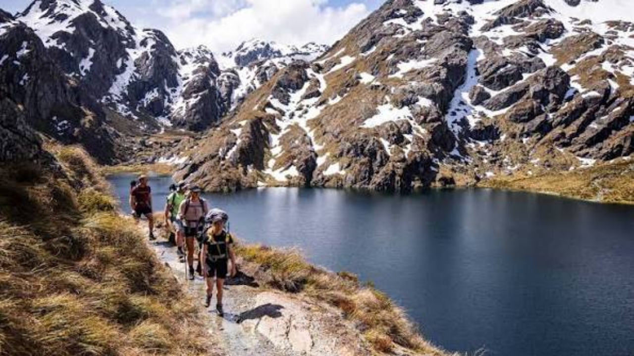
Routeburn Track is one of New Zealand’s most spectacular multi-day hiking routes, connecting the dramatic landscapes of Mount Aspiring National Park and Fiordland National Park. The trail crosses part of the Southern Alps, passes through beech forests and alpine meadows, climbs toward Harris Saddle, and offers spectacular views across valleys, mountains, lakes, and waterfalls.
Unlike many long-distance trails that stay within one type of environment, the Routeburn Track changes constantly. One moment you can be walking beside a clear mountain stream, and a few hours later you can be looking across an exposed alpine landscape surrounded by rugged peaks.
The Routeburn Track is also one of New Zealand’s Great Walks, a collection of premier walking routes managed by the Department of Conservation. The official route is approximately 32 kilometres and can be completed in around 2–4 days, depending on your itinerary.
The trail is particularly impressive because it connects two internationally significant national parks within the Te Wāhipounamu – South West New Zealand World Heritage Area. Along the way, hikers encounter landscapes shaped by glaciers, forests filled with native birds, alpine wetlands, reflective tarns, and enormous mountain ranges.
Whether you are interested in scenery, photography, wildlife, geology, or simply experiencing one of New Zealand’s finest hiking destinations, there are plenty of reasons to put the Routeburn Track on your travel list.
1. Routeburn Track Connects Two Incredible National Parks

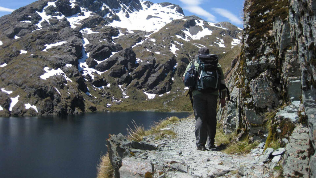
One of the most remarkable things about the Routeburn Track is that it passes through both Mount Aspiring National Park and Fiordland National Park.
These two protected areas are famous for their dramatic mountain scenery and wilderness environments. The trail effectively links the Routeburn Valley near Glenorchy with The Divide near Te Anau, crossing the Southern Alps along the way.
The Department of Conservation describes the route as a Great Walk that links Mount Aspiring and Fiordland National Parks within the Te Wāhipounamu – South West New Zealand World Heritage Area.
This means that a single journey gives you access to two extraordinary landscapes.
Mount Aspiring National Park is known for rugged peaks, valleys, rivers, glaciers, and extensive wilderness. Fiordland, meanwhile, is famous for its enormous mountains, deep valleys, lakes, waterfalls, and famously changeable weather.
The Routeburn Track sits between these environments and allows hikers to experience their differences gradually.
Rather than treating the two parks as separate destinations, the trail demonstrates how naturally they connect.
The changing scenery is one of the biggest reasons the Routeburn Track feels so rewarding. You are constantly moving between different elevations and environments, with each section offering something new.
2. The Alpine Scenery Is Absolutely Spectacular
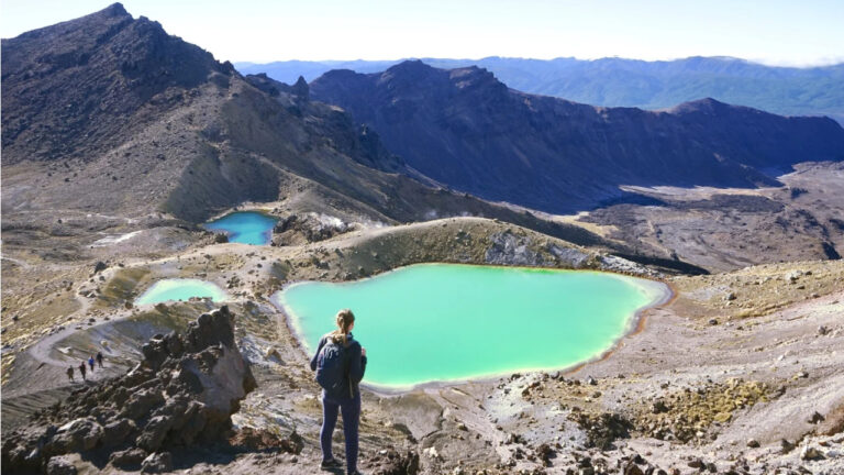
The mountain scenery is arguably the biggest attraction of the Routeburn Track.
As the trail gains elevation, the surrounding landscape becomes increasingly dramatic. Large mountain ranges rise above the valleys, while alpine meadows and rocky slopes create a striking foreground.
The trail reaches Harris Saddle, also known as Tarahaka Whakatipu, at approximately 1,255 metres. This is the highest point of the main Routeburn Track and one of its most memorable locations.
From this elevated section, the landscape opens dramatically.
Instead of being surrounded by forest, hikers can look across expansive valleys and toward the rugged Darran Mountains.
The scenery is particularly impressive because it feels genuinely wild.
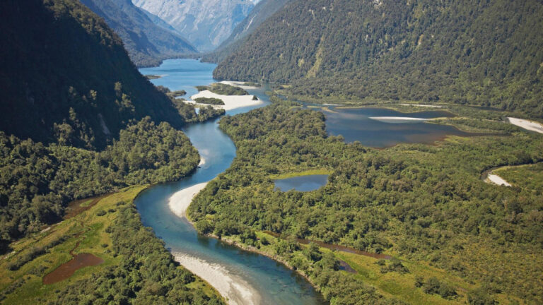
There are no major cities or developed areas surrounding the trail. Instead, you encounter mountains, rivers, forests, alpine vegetation, and enormous stretches of wilderness.
This sense of isolation gives the Routeburn Track a very different atmosphere from shorter day hikes close to major towns.
The scenery also changes depending on the weather.
On a clear day, distant peaks may be sharply visible beneath a blue sky. When clouds move through the mountains, the landscape can become moody and mysterious.
Rain, mist, and low cloud are common features of the region, so hikers should expect the possibility of several different weather conditions during the same trip.
3. Routeburn Falls Is a Beautiful Early Highlight
Routeburn Falls provides one of the most memorable stops along the eastern portion of the Routeburn Track.
The trail climbs from Routeburn Flats through beech forest toward Routeburn Falls Hut, which sits near the bushline.
The Department of Conservation lists the section between Routeburn Flats Hut and Routeburn Falls Hut as approximately 2.3 kilometres, generally taking between one and one and a half hours.
The waterfall itself adds another layer to an already beautiful landscape.
The sound of flowing water becomes a natural companion as the trail climbs, while openings in the forest provide views toward the surrounding mountains.
Routeburn Falls Hut is also an important overnight stop for many hikers following the traditional three-day itinerary.
The hut sits in a scenic alpine setting, making it an excellent place to pause and appreciate the environment around you.
During the Great Walks season, the huts have facilities including bunks, mattresses, heating, toilets, basic cooking facilities, solar-powered lighting, and cold running water. However, hikers need to bring their own food, cooking utensils, showers are not available, and bedding is not provided.
For many people, staying at Routeburn Falls becomes part of the experience rather than simply a practical necessity.
4. Harris Saddle Is the High Point of the Journey
Harris Saddle is one of the defining locations of the Routeburn Track.
At approximately 1,255 metres above sea level, it marks the highest point of the trail and provides access to some of its most impressive alpine scenery.
The approach toward the saddle is particularly beautiful.
After leaving Routeburn Falls Hut, the trail climbs through a landscape of wetlands and tussock-covered flats before continuing along the valley.
As you gain elevation, the scenery becomes more exposed.
Eventually, you reach the area around Lake Harris, where the mountains and alpine environment create a dramatic backdrop.
The Routeburn Track then crosses Harris Saddle before descending toward the Hollyford Valley.
The saddle itself is also an important decision point because weather conditions can be significantly different at higher elevations.
Strong winds, rain, snow, and low temperatures can occur even when conditions lower down appear pleasant.
That is one reason the Routeburn Track should be approached as a genuine alpine journey.
The scenery may be spectacular, but the environment can also be demanding.
Hikers who reach Harris Saddle in good conditions are rewarded with enormous views across the surrounding landscape.
It is one of those places where the scale of the Southern Alps becomes particularly easy to appreciate.
5. Lake Mackenzie Creates a Peaceful Alpine Setting
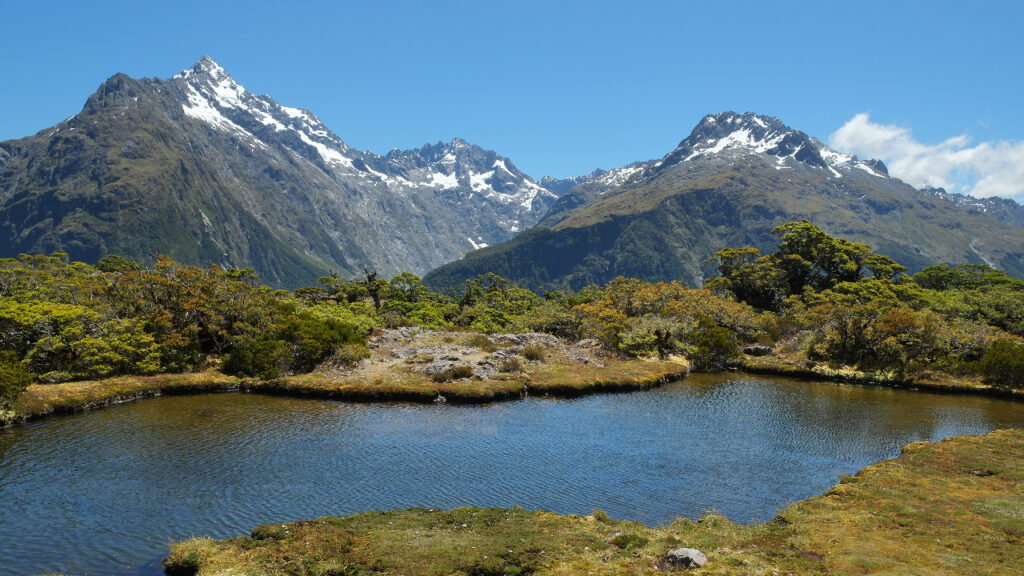
After crossing Harris Saddle, the Routeburn Track eventually descends toward Lake Mackenzie.
The lake provides a striking contrast to the exposed alpine terrain higher on the trail.
Surrounded by mountains and vegetation, Lake Mackenzie has a peaceful atmosphere that makes it an especially memorable overnight location.
Lake Mackenzie Hut sits beside the lake and is another major accommodation point along the traditional itinerary.
The journey from Routeburn Falls Hut to Lake Mackenzie Hut is approximately 11.3 kilometres and usually takes between four and a half and six hours, according to DOC.
This section is one of the most varied parts of the trail.
The Routeburn Track passes through wetlands and tussock-covered terrain, follows the area around Lake Harris, crosses the exposed Hollyford Face, and eventually descends toward Lake Mackenzie.
That variety makes the day feel like several different hikes combined into one.
By the time you reach Lake Mackenzie, the environment feels considerably different from the high alpine terrain around Harris Saddle.
The lake is therefore not only a practical overnight stop but also a rewarding destination in its own right.
Taking time to appreciate the surrounding landscape can be one of the quieter and more relaxing moments of the entire journey.
6. The Routeburn Track Has Incredible Native Forests
Although the high alpine scenery receives much of the attention, the forests are another major feature of the Routeburn Track.
Large portions of the route pass through beech forest, creating a completely different hiking environment from the open alpine sections.
The forest provides shelter from the elements and introduces hikers to one of New Zealand’s distinctive native ecosystems.
Walking beneath the trees can also make the transition between environments particularly noticeable.
You may begin among dense vegetation and gradually climb toward the bushline, where the forest becomes shorter and eventually gives way to open alpine terrain.
The Department of Conservation notes that the Routeburn Track passes through stunning beech forest, including the section between Routeburn Flats and Routeburn Falls.
The forests are also important habitats for native birds.
The Key Summit section near The Divide, for example, is known for birdlife including tomtits, New Zealand robins, kererū, and bellbirds.
For hikers who enjoy nature, these quieter forest sections provide an opportunity to slow down.
Instead of focusing only on distant mountains, you can listen to bird calls, observe vegetation, and notice how the environment changes with altitude.
This variety makes the Routeburn Track appealing to people who enjoy both mountain scenery and forest ecosystems.
7. Earland Falls Adds Another Stunning Waterfall
Earland Falls is another major attraction along the Routeburn Track.
The waterfall is approximately 174 metres high and originates from Lake Roberts.
It can be reached as part of the section between Lake Howden and Lake Mackenzie, making it an impressive feature during the descent through the western portion of the trail.
The scale of the waterfall is particularly striking when viewed against the surrounding landscape.
Water rushes down the mountain while forest, cliffs, and alpine peaks form the backdrop.
The route near Earland Falls also provides opportunities to look across the Hollyford Valley.
This combination of waterfall and mountain scenery demonstrates why the Routeburn Track is much more than a simple point-to-point walk.
The trail continually introduces new landscapes.
If you are planning a shorter visit rather than completing the entire Routeburn Track, DOC also identifies an Earland Falls day-walk option from The Divide. The route follows the main trail toward Lake Howden and continues to the waterfall before returning the same way.
This makes Earland Falls a useful option for travelers who want to experience a section of the trail without completing the entire multi-day route.
8. Key Summit Offers a Fantastic Shorter Walk
One of the most useful alternatives connected to the Routeburn Track is the Key Summit Track.
It is particularly appealing if you have limited time but still want to experience alpine scenery.
The walk begins at The Divide, along Milford Road, and follows the Routeburn Track before turning toward Key Summit.
The final climb takes you above the bushline, where you reach an alpine environment featuring wetlands, tarns, bogs, and wide mountain views.
DOC describes the Key Summit walk as a half-day option with panoramic views toward the Humboldt and Darran Mountains and the Hollyford Valley.
The area is also interesting from a geological perspective.
During the last ice age, a huge glacier flowed through the Hollyford Valley and reached above Key Summit before splitting into different valleys.
This gives the landscape a fascinating geological story.
You are not simply looking at mountains and lakes; you are seeing terrain that has been heavily shaped by glaciers over thousands of years.
For travelers who cannot dedicate several days to the Routeburn Track, Key Summit can provide a rewarding introduction to the scenery.
It also demonstrates how the wider Routeburn area offers options for different hiking itineraries.
9. Routeburn Track Is Perfect for Landscape Photography
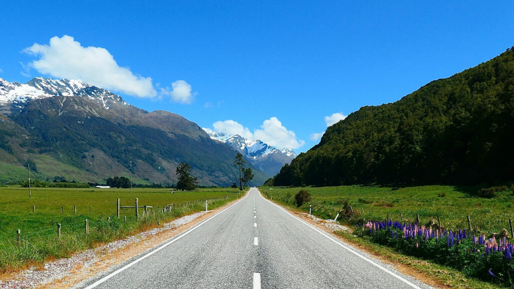
The Routeburn Track is an excellent destination for anyone who enjoys landscape photography.
The trail offers an unusually wide range of photographic subjects.
There are waterfalls, mountain peaks, reflective lakes, alpine wetlands, forest paths, rivers, tussock-covered slopes, and dramatic valleys.
Each section creates a different composition.
Routeburn Falls can provide opportunities to photograph moving water against a forested mountain backdrop.
Lake Harris offers expansive alpine views, while the Hollyford Face provides enormous views toward the Darran Mountains.
Lake Mackenzie brings a calmer setting, with water and mountains creating reflections when conditions are suitable.
The changing weather also contributes to the photographic experience.
Mist can move through valleys, clouds can partially cover mountain peaks, and changing sunlight can highlight different parts of the landscape.
Because Fiordland receives extremely high rainfall, wet conditions are a normal part of the environment rather than an unusual event. DOC notes that Fiordland can receive up to 9,000 millimetres of rainfall annually and that weather can change quickly in any season.
That means photographers should be prepared to work with changing conditions.
A dramatic photograph does not always require perfect sunshine.
Cloud, mist, and rain can give the Routeburn Track a distinctive atmosphere that sunny weather cannot reproduce.
10. Routeburn Track Gives You a Genuine Wilderness Experience
Perhaps the greatest reason to hike the Routeburn Track is the feeling of being immersed in nature.
The trail connects two national parks and passes through environments where mountains, forests, rivers, lakes, and alpine landscapes dominate the surroundings.
There are no major urban developments along the route.
Instead, hikers spend several days moving through a landscape shaped by natural forces.
This creates a strong sense of distance from everyday life.
The journey also encourages a slower pace.
You cannot simply drive from one viewpoint to another.
You have to walk through the environment, carrying your equipment and experiencing each change in scenery gradually.
That physical progression can make the destination feel more rewarding.
The Routeburn Track is also well marked and maintained during the Great Walks season, although some sections are steep, rough, muddy, or slippery and conditions can make the route challenging.
The combination of accessibility and wilderness is one of its biggest strengths.
You can experience a genuinely spectacular mountain environment while following a well-established Great Walk rather than an entirely remote route.
For many hikers, that balance makes the Routeburn Track one of New Zealand’s most appealing multi-day adventures.
What Is the Routeburn Track Like?
The Routeburn Track is a one-way route, meaning transportation needs to be organized between the two ends.
The trail can be walked in either direction, with one end at Routeburn Shelter near Glenorchy and the other at The Divide on Milford Road. DOC notes that the road distance between the two trailheads is approximately 325 kilometres, so hikers need to arrange transportation between them.
The traditional itinerary takes three days and two nights, although DOC lists the overall hiking duration as 2–4 days depending on how the trip is planned.
A typical itinerary involves staying at Routeburn Falls Hut on the first night and Lake Mackenzie Hut on the second.
The middle day is the longest and includes the crossing of Harris Saddle.
The final day continues from Lake Mackenzie toward The Divide.
However, itineraries can be adjusted.
Some hikers add extra nights, while others connect with the Greenstone and Caples Tracks to create a longer adventure.
The key is to choose a plan that matches your fitness, experience, weather conditions, and available daylight.
When Is the Best Time to Hike the Routeburn Track?
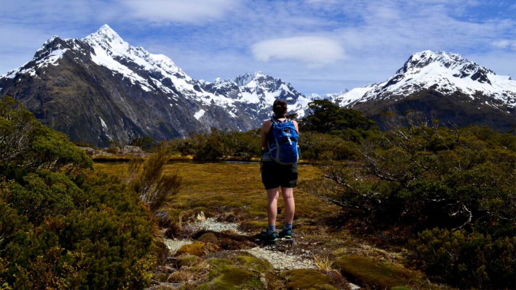
The Great Walks season runs from 1 November through 30 April.
During this period, the huts and campsites operate with their Great Walks facilities, and bookings are required for overnight stays. DOC states that bookings for the 2026/27 season are currently open.
For most hikers without specialist alpine experience, this is the most suitable time to plan a Routeburn Track trip.
However, even during the warmer months, weather can change rapidly.
Snow, cold temperatures, strong winds, and heavy rain can occur at any time.
Avalanche risk can also extend into December, and DOC manages avalanche hazards during the Great Walk season. Sections of the trail may be closed when necessary.
Outside the Great Walks season, from May through October, the Routeburn Track becomes significantly more challenging.
DOC states that winter travel requires alpine skills, appropriate equipment, and experience. Snow, ice, avalanche terrain, freezing temperatures, reduced facilities, and shorter daylight hours all increase the difficulty.
For that reason, the warmer Great Walks season is generally the better choice for ordinary visitors.
What Should You Pack for the Routeburn Track?
Packing correctly is important because the Routeburn Track passes through a remote and changeable mountain environment.
Weather-appropriate clothing should be a priority.
A waterproof outer layer, warm insulating layers, comfortable hiking clothing, and sturdy footwear are all important.
You should also carry enough food for your planned journey as well as emergency food in case weather delays your trip.
The DOC huts provide basic cooking facilities during the Great Walks season, but food, cooking utensils, bedding, and showers are not provided.
A reliable water strategy is also important.
DOC specifically warns about didymo, an invasive freshwater algae found at several locations along the Routeburn Track, including Potters Creek, Deadmans Creek, and No Name Creek.
Visitors are asked to follow Check, Clean, Dry practices and avoid taking water from those areas.
A first-aid kit, navigation tools, headlamp, sun protection, insect protection, and appropriate personal equipment are also sensible additions.
Remember that there is no cellphone coverage during the winter season, according to DOC, and communication should not be treated as guaranteed in the wilderness.
Preparation is therefore much more important than packing light at all costs.
How Difficult Is the Routeburn Track?
The Routeburn Track is accessible to experienced hikers, but it should not be treated as an easy walk.
The route contains steep and rough sections, and some parts have exposed drop-offs.
DOC specifically warns that steep drop-offs occur along sections of the entire track.
The middle section around Harris Saddle is particularly important because it takes hikers into exposed alpine terrain.
Weather can significantly increase the difficulty.
Heavy rain can cause flooding on sections of the trail, and DOC advises hikers never to attempt stream crossings when water levels are dangerous.
Winter adds another level of difficulty.
Snow, ice, avalanche terrain, and freezing conditions mean the Routeburn Track should only be attempted outside the Great Walks season by people with appropriate alpine skills and equipment.
This is why checking current conditions is essential.
A route that is enjoyable in favorable summer weather can become considerably more demanding under poor conditions.
The trail itself may be well marked, but mountain environments cannot be made completely predictable.
Respecting the conditions is part of responsible hiking.
Why Routeburn Track Belongs on Your New Zealand Itinerary
The Routeburn Track combines many of the things travelers seek from a New Zealand hiking experience.
There are towering mountains, native forests, waterfalls, alpine wetlands, lakes, valleys, and enormous views.
The route also provides a genuine sense of wilderness while remaining one of the country’s established Great Walks.
Its location between Mount Aspiring National Park and Fiordland National Park adds another layer of appeal.
You are effectively moving between two of New Zealand’s most important protected landscapes during a single journey.
The Routeburn Track also provides different ways to experience the region.
You can commit to the traditional multi-day hike, extend the trip, explore connected tracks, or experience shorter sections such as Key Summit or Earland Falls.
That flexibility makes the area appealing to different types of travelers.
Perhaps most importantly, the scenery rewards you throughout the journey.
There is no single viewpoint that represents the entire trail.
The experience comes from the sequence of landscapes: forest, river, waterfall, meadow, alpine ridge, lake, valley, and mountain.
Each section contributes something different.
Final Thoughts on Routeburn Track
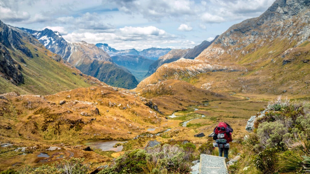
Routeburn Track is an extraordinary example of why New Zealand is considered one of the world’s great hiking destinations.
The trail crosses between Mount Aspiring National Park and Fiordland National Park, travels through the Southern Alps, and provides access to some of the most impressive mountain scenery on the South Island.
From Routeburn Falls and Lake Harris to Harris Saddle, Lake Mackenzie, Earland Falls, and Key Summit, the route offers a remarkable variety of landscapes.
The Routeburn Track is also a journey that rewards preparation.
The weather can change quickly, rainfall is extremely high in the wider Fiordland region, and alpine conditions can create serious challenges outside the main hiking season.
During winter, the route requires considerably more experience and specialist equipment.
For most visitors, the Great Walks season provides the most accessible opportunity to experience the trail, but even then, checking conditions before departure is essential.
If you are looking for a New Zealand hike that combines dramatic mountains, peaceful forests, waterfalls, alpine lakes, and a genuine wilderness atmosphere, the Routeburn Track deserves serious consideration.
It is not simply a walk from one trailhead to another.
It is a journey through two extraordinary national parks and some of the most spectacular scenery in the Southern Alps.
With careful planning, respect for the environment, and an itinerary suited to the conditions, the Routeburn Track can become one of the most memorable hiking experiences of a New Zealand adventure.